Devils Lake
Devils Lake History
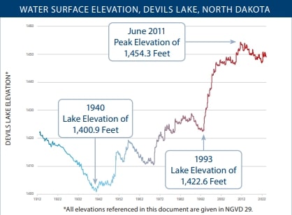
Since glaciation, Devils Lake water levels have been under constant fluctuation, from overflowing to dry - mirroring long-term climate patterns in the region. Devils Lake reached its lowest level in recorded history in 1940 at an elevation of 1,401 feet. Then, from a more recent low point of 1,422.6 feet in 1993, the lake rose 31.68 feet to an elevation of 1,454.3 feet in 2011.
At elevation 1,458, Devils Lake naturally overflows through Tolna Coulee, into the Sheyenne River. The Sheyenne River is a tributary of the Red River of the North, which flows into Canada. A natural overflow of Devils Lake would adversely affect downstream communities and rural areas alike due to flooding and water quality impacts. For that reason, the mitigation efforts outlined in this fact sheet have been actively pursued through local, state, and federal cooperative efforts.
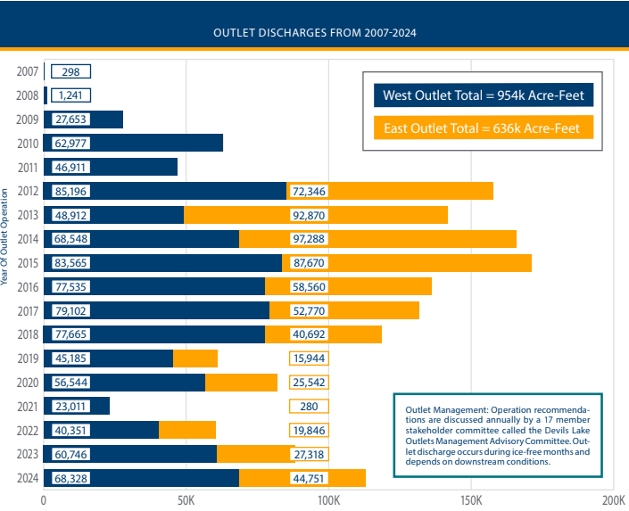
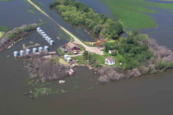
Since 1993, the Devils Lake Basin has experienced a wet cycle that has flooded communities and tens of thousands of acres of agricultural land - forcing the abandonment of homes, roads, and other facilities. These conditions led to the State of North Dakota taking an active role in flood prevention and mitigation in the basin. Specifically, the State constructed and operates two outlets to the Sheyenne River; cooperated with the federal government on completion of a control structure at Tolna Coulee; implemented basin water management; and raised roads, bridges, and other critical infrastructure out of harm’s way.
Timeline of Devils Lake Flooding
1993
about 261 square miles. During that same time period, the volume of
water in Devils Lake had grown by more than seven times.
2005
2009
2011
2012
In addition to the outlets, the U.S. Army Corps of Engineers constructed a control structure at Tolna Coulee to prevent a catastrophic over-flow of Devils Lake. In May, the control structure was completed and ready for operation.
2014
By the Numbers
Spill Elevation - 1,458.0 feet
At the Spill Elevation - 261,000 acres
Outlets - Toulna Coulee
Outlets - 600 cubic feet per second
Outlet Control Structure